The Bridgers - Ridge Profile
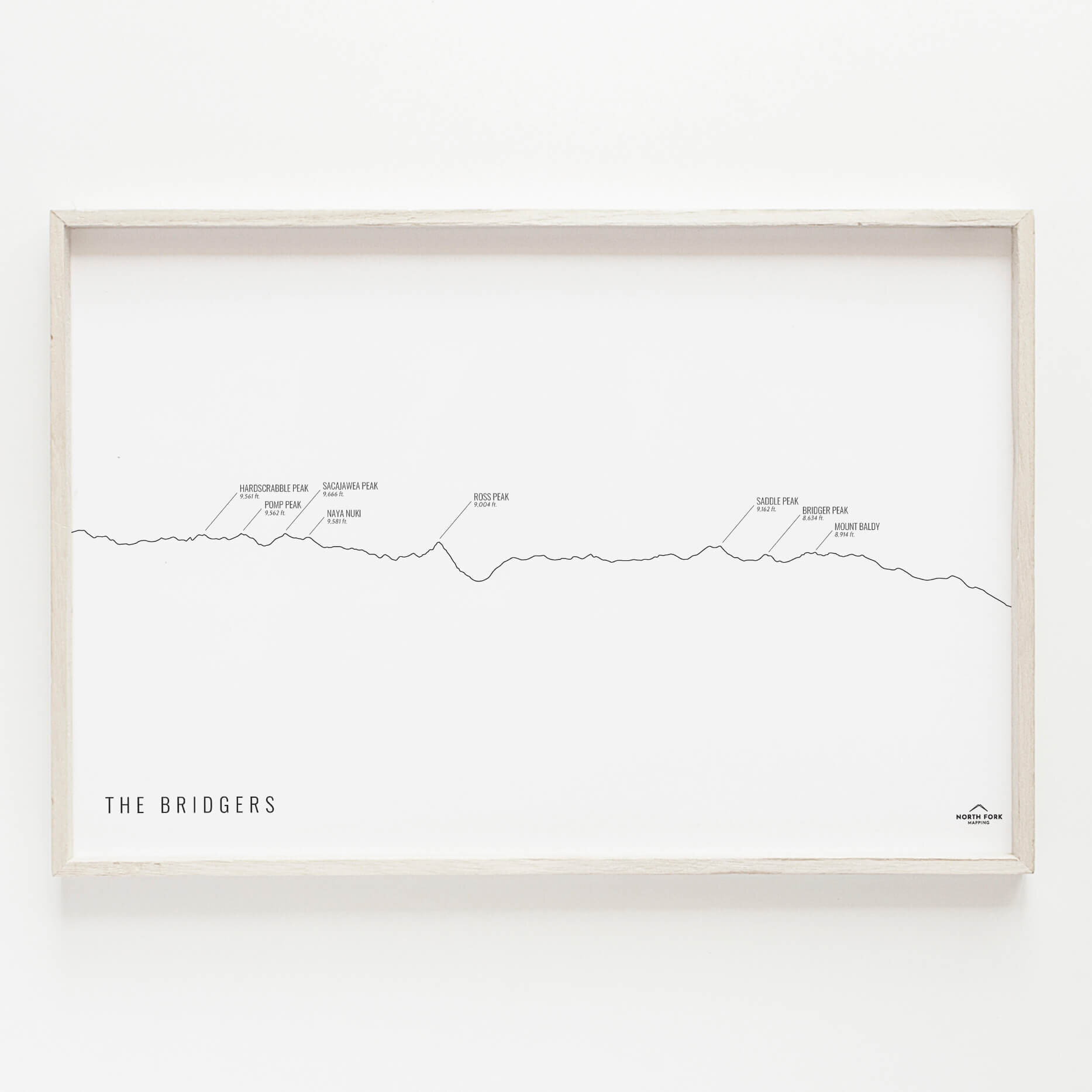
A step away from birds-eye view mapping, we’ve produced a ridge profile of The Bridgers with labeled peaks as seen from the west side of the mountain range. We often wonder which peak we’re looking at when looking at a mountain range and this helps with those questions. Hardscrabble Peak, Pomp Peak, Sacajawea Peak, Naya Nuki, Ross Peak, Saddle Peak, Bridger Peak, and Mount Baldy are delineated in this labeled Bridger Peaks print.
Prints are shown framed for display purposes only.
Sizes are for ease of framing (typical frame sizes); however, if you’d like a custom size, we’re happy to accommodate for a small fee to set up the new size - shoot us an email.