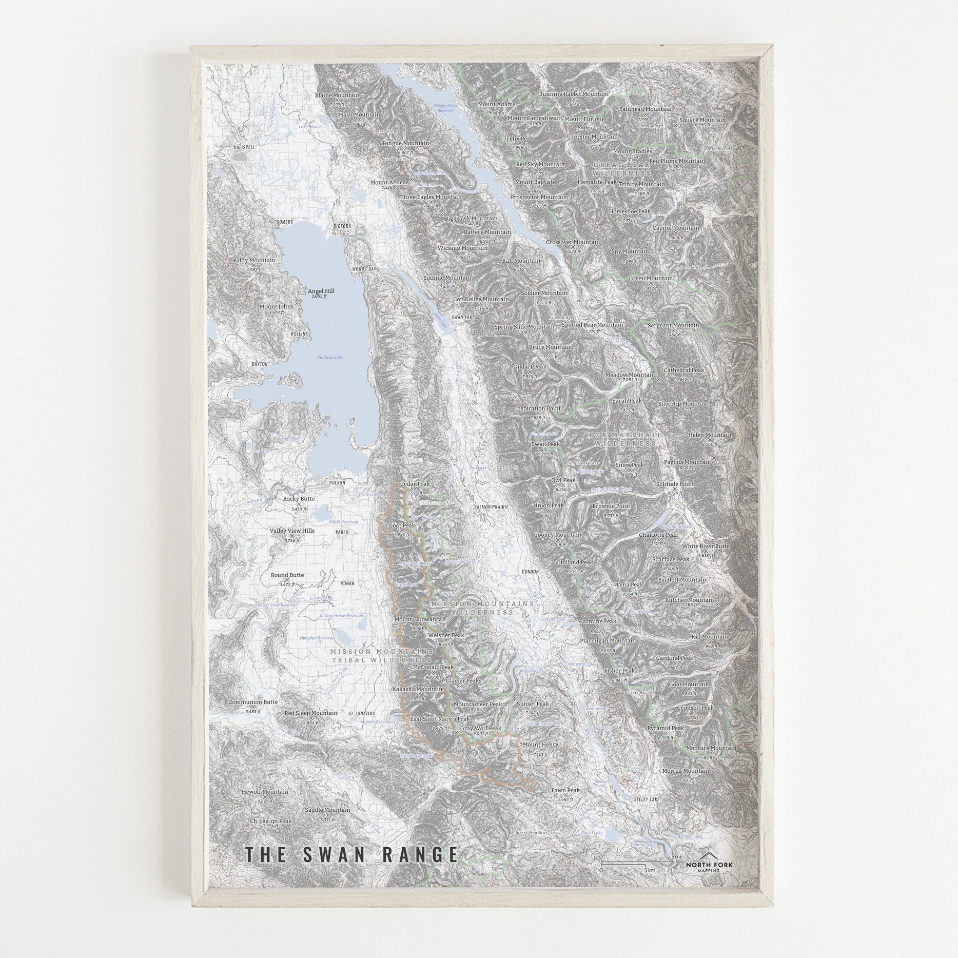
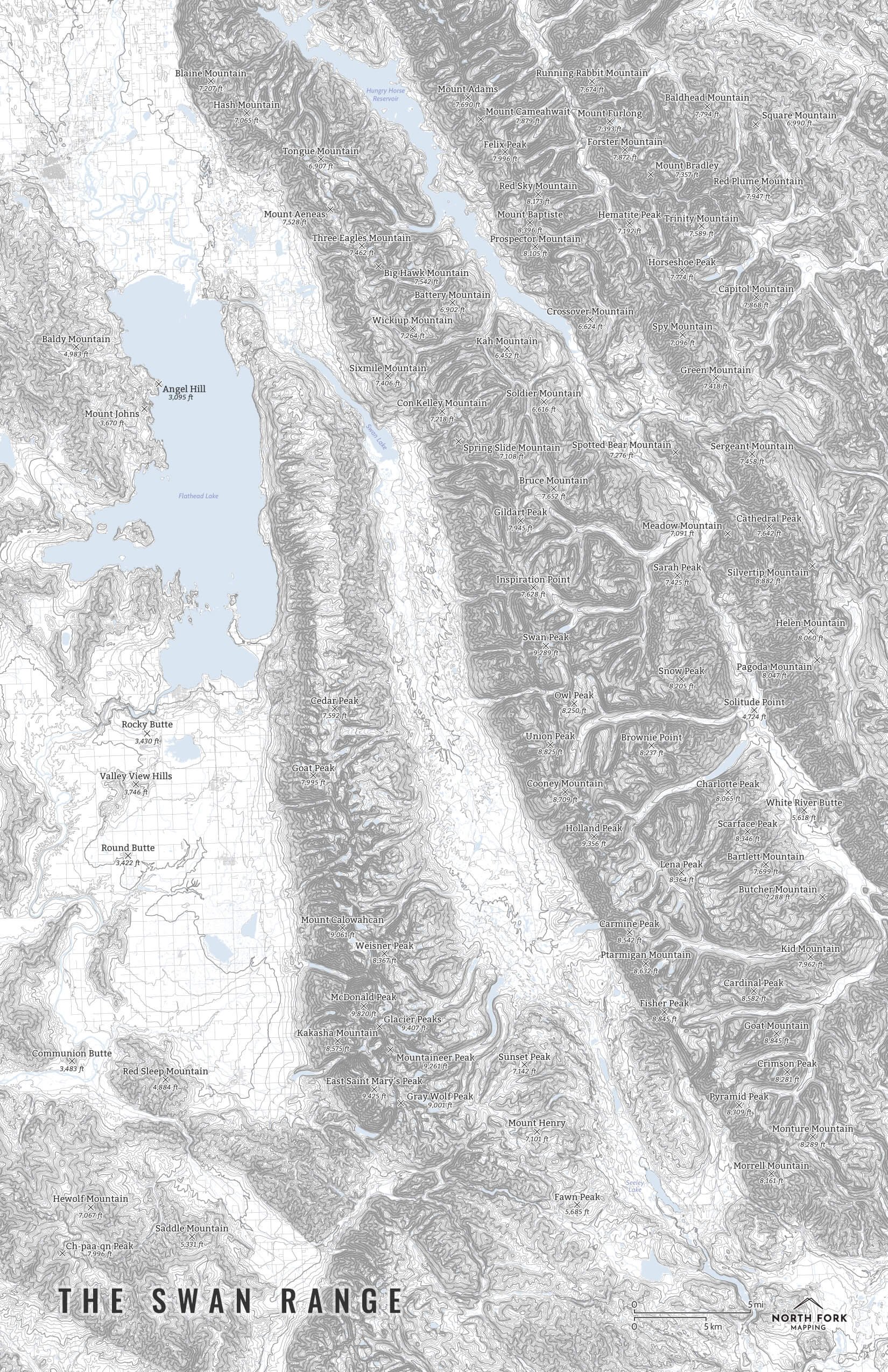
Zion National Park
A map of Zion National Park. From The Narrows to Angels Landing, we’ve got you covered with this map. In 1909 President Taft created Mukuntuweap National Monument and in 1927, the acting director of the National Park Service (NPS) changed its name to Zion. In 1919, the United States Congress added more land and established Zion National Park. A separate Zion National Monument, the Kolob Canyons area, was incorporated into the park in 1956.
See below for descriptions on our three signature styles.
Prints are shown framed for display purposes only.
Zion National Park!
We have three signature styles of map depending on what you’re looking for:
“Minimalist” - Title and topo lines with a very faint road network underneath for reference as well as hydrology and the park boundary. Clean, simple, elegant. More of an “art” look than a “map” look.
“Just The Basics” - Adding onto the minimalist style with summit names and elevations and entrance areas as well as a scale bar. A basic map.
“All The Things” - Just as it sounds. The mappiest of them all. Adding common place names, hydrology labels, trails, and other elements.