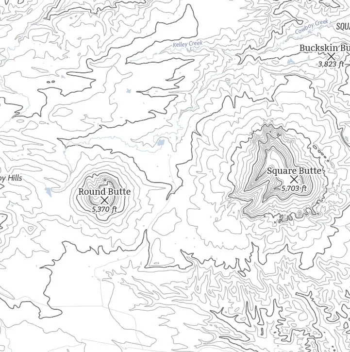
Image 1 of 5
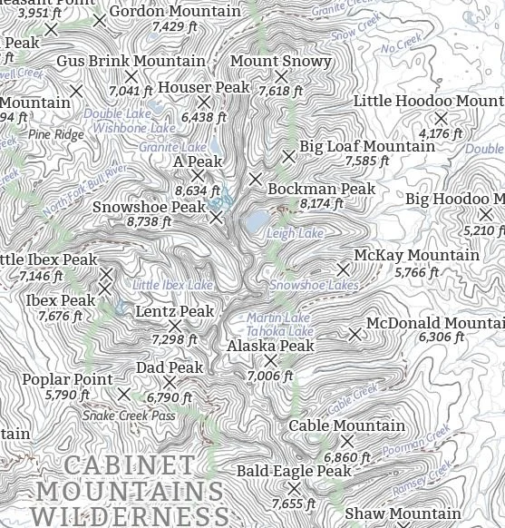 Image 2 of 5
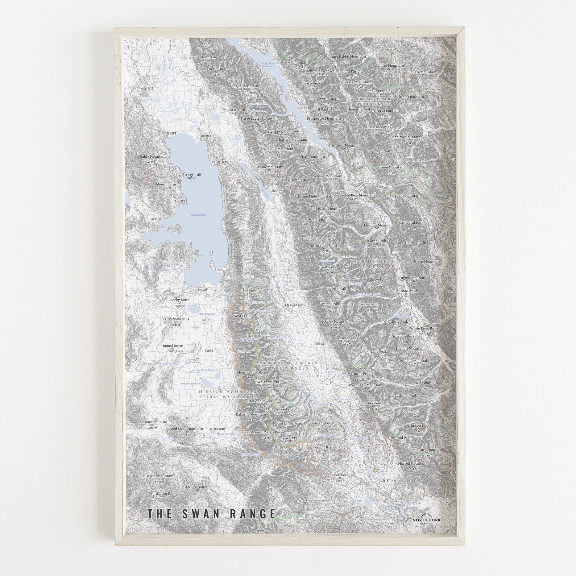
 Image 3 of 5
 Image 4 of 5
 Image 5 of 5
A map of the Bitterroot Valley!
We have three signature styles of map depending on what you’re looking for:
“Minimalist” - This map has the title as well as hydrology and contour lines. Clean, simple, elegant. More of an “art” look than a “map” look.
“Just The Basics” - Adding onto the minimalist style with a road network for reference, mountain summit points, state boundary, and a scale bar. A basic map.
“All The Things” - Just as it sounds. The mappiest of them all. Adds in trails, lake labels, stream labels, town labels, wilderness boundaries and labels, and common place name labels.