Image 1 of 5
 Image 2 of 5
 Image 3 of 5
 Image 4 of 5
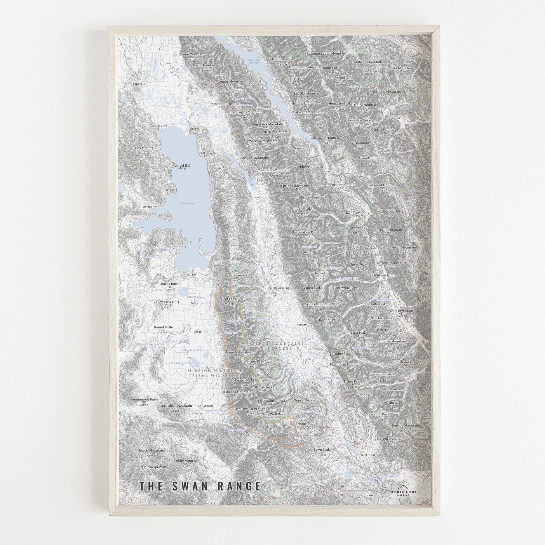
 Image 5 of 5
Map of the Absaroka Beartooth Wilderness!
We have three signature styles of map depending on what you’re looking for:
“Minimalist” - This map has the title and hillshade as well as hydrology, glaciers, and a faint road network for reference. Clean, simple, elegant. More of an “art” look than a “map” look.
“Just The Basics” - Adding onto the minimalist style with NPS and USFS shading as well as mountain summits. A basic map.
“All The Things” - Just as it sounds. The mappiest of them all. Adds in town names, trails, common place names, state boundary and labels, glacier labels, labels for mountain ranges and NPS, stream and lake labels.