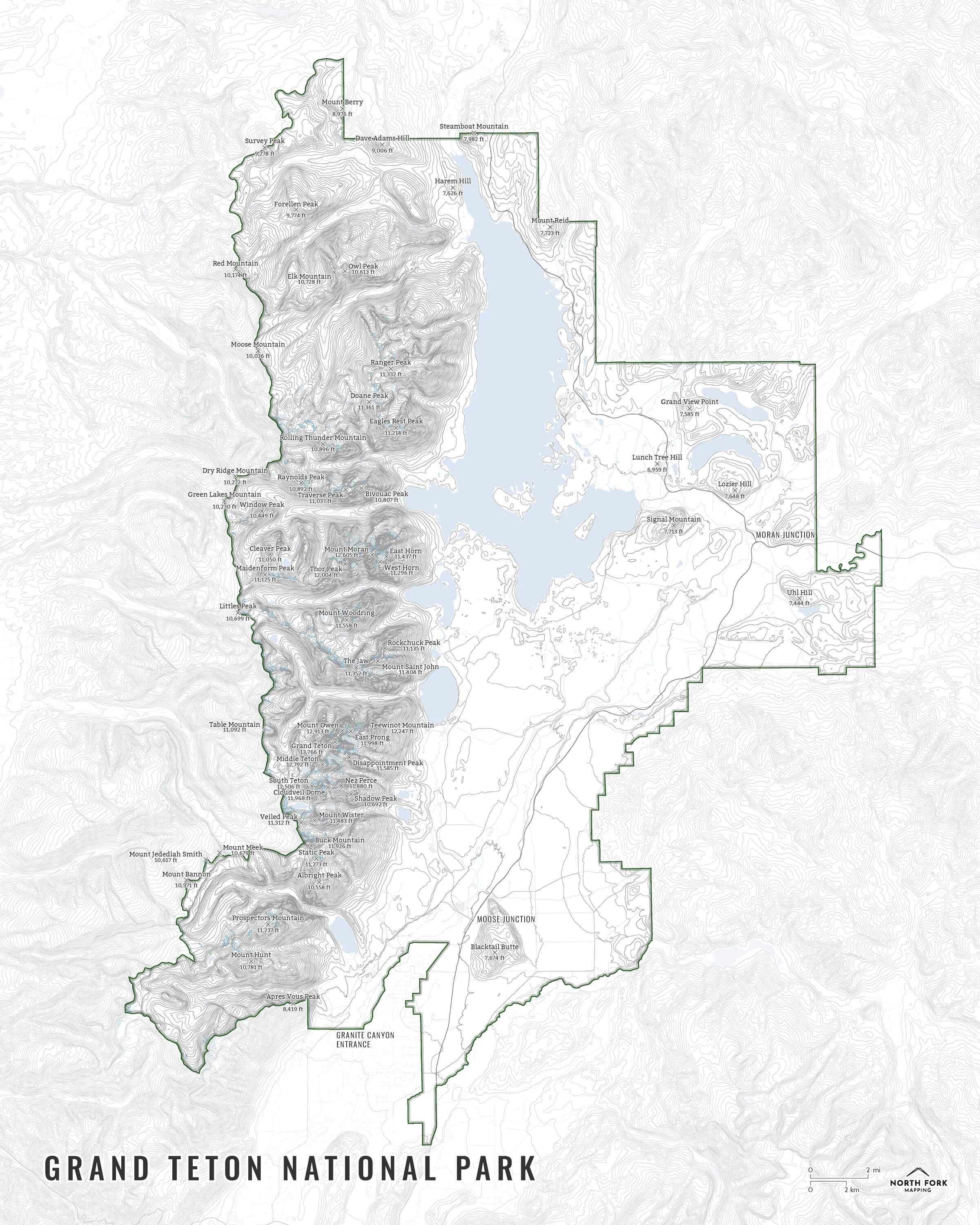
Image 1 of 5
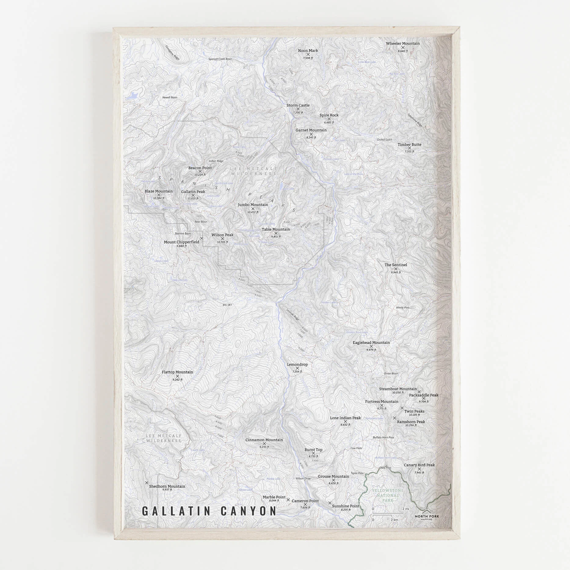
 Image 2 of 5
 Image 3 of 5
 Image 4 of 5
 Image 5 of 5
Madison Range Map!
We have three signature styles of map depending on what you’re looking for:
“Minimalist” - Title and topo lines with a very faint road network underneath for reference as well as rivers and lakes. Clean, simple, elegant. More of an “art” look than a “map” look.
“Just The Basics” - Adding onto the minimalist style with summit names and elevations and labels for Ennis and Hebgen Lakes as well as the Madison and Gallatin Rivers, as well as a scale bar. A basic map.
“All The Things” - Just as it sounds. The mappiest of them all. Adding common place names, lake and stream labels, town labels, trails, Yellowstone park boundary, Lee Metcalf Wilderness boundary, state boundary and labels, contour labels, and other elements.