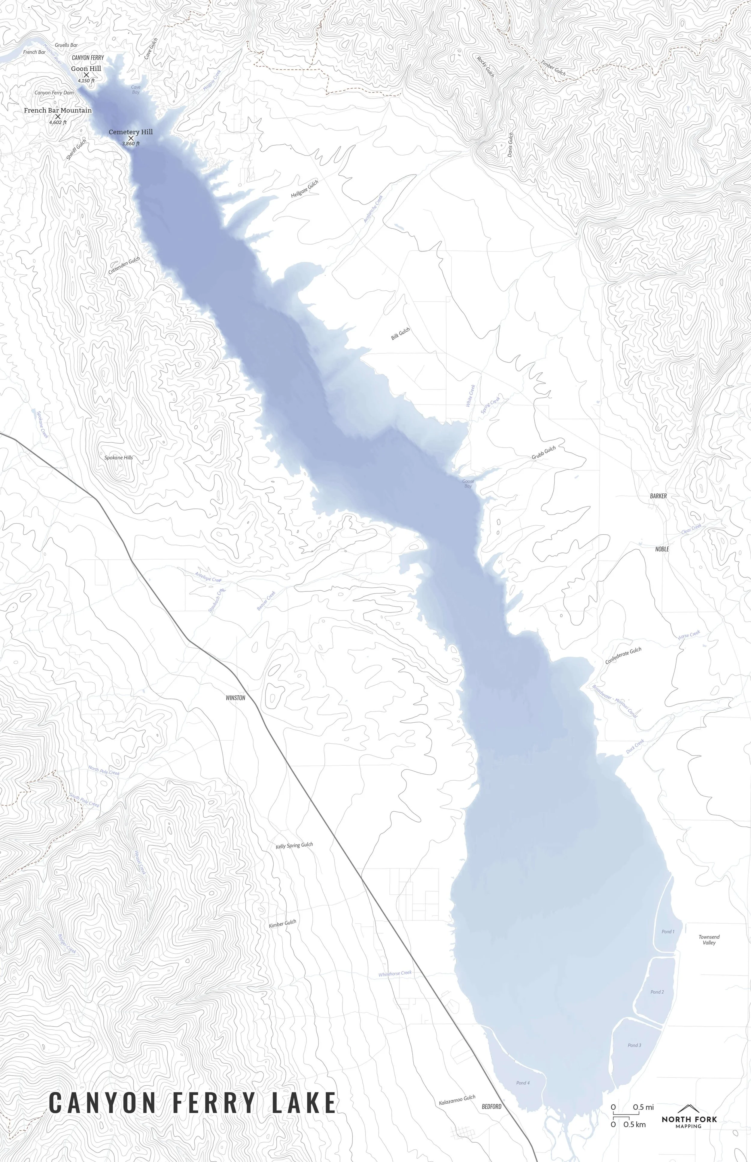
Skip to Content
North Fork Mapping
Home
Shop Maps
Custom Maps
Stockists
Wholesale
About
FAQs
Artist Resources
Contact
Follow us on Instagram
Follow us on Facebook
0
0
North Fork Mapping
Home
Shop Maps
Custom Maps
Stockists
Wholesale
About
FAQs
Artist Resources
Contact
Follow us on Instagram
Follow us on Facebook
0
0
Home
Shop Maps
Custom Maps
Stockists
Wholesale
Folder: About
Back
FAQs
Artist Resources
Contact
Follow us on Instagram
Follow us on Facebook
Shop Maps Canyon Ferry Lake
CanyonFerryLakeMap_NorthForkMapping.jpg Image 1 of 5
CanyonFerryLakeMap_NorthForkMapping.jpg
CanyonFerryLake.JPG Image 2 of 5
CanyonFerryLake.JPG
CanyonFerryLake_all_11x17-01.jpg Image 3 of 5
CanyonFerryLake_all_11x17-01.jpg
CanyonFerryLake_bas_11x17-01.jpg Image 4 of 5
CanyonFerryLake_bas_11x17-01.jpg
CanyonFerryLake_min_noroads_11x17-01.jpg Image 5 of 5
CanyonFerryLake_min_noroads_11x17-01.jpg
CanyonFerryLakeMap_NorthForkMapping.jpg
CanyonFerryLake.JPG
CanyonFerryLake_all_11x17-01.jpg
CanyonFerryLake_bas_11x17-01.jpg
CanyonFerryLake_min_noroads_11x17-01.jpg

Canyon Ferry Lake

from $34.00

A map of Canyon Ferry Lake with bathymetry showing the true depths of the lake. Canyon Ferry Lake is Montana’s third largest body of water and formed by building the Canyon Ferry Dam in 1954 on the Missouri River. It is extremely popular for fishing and boating. The town of Canton lies beneath the lake having been submerged when the final dam was constructed. The lake itself is near Helena and Townsend, Montana.

See below for descriptions on our three signature styles.

Prints are shown framed for display purposes only.

Size:
Style:
Quantity:
Add Canyon Ferry Lake Map to Cart

A map of Canyon Ferry Lake with bathymetry showing the true depths of the lake. Canyon Ferry Lake is Montana’s third largest body of water and formed by building the Canyon Ferry Dam in 1954 on the Missouri River. It is extremely popular for fishing and boating. The town of Canton lies beneath the lake having been submerged when the final dam was constructed. The lake itself is near Helena and Townsend, Montana.

See below for descriptions on our three signature styles.

Prints are shown framed for display purposes only.

Canyon Ferry Lake Map!

We have three signature styles of map depending on what you’re looking for:

“Minimalist” - This map has the title as well as hydrology and contour lines. Clean, simple, elegant. More of an “art” look than a “map” look.

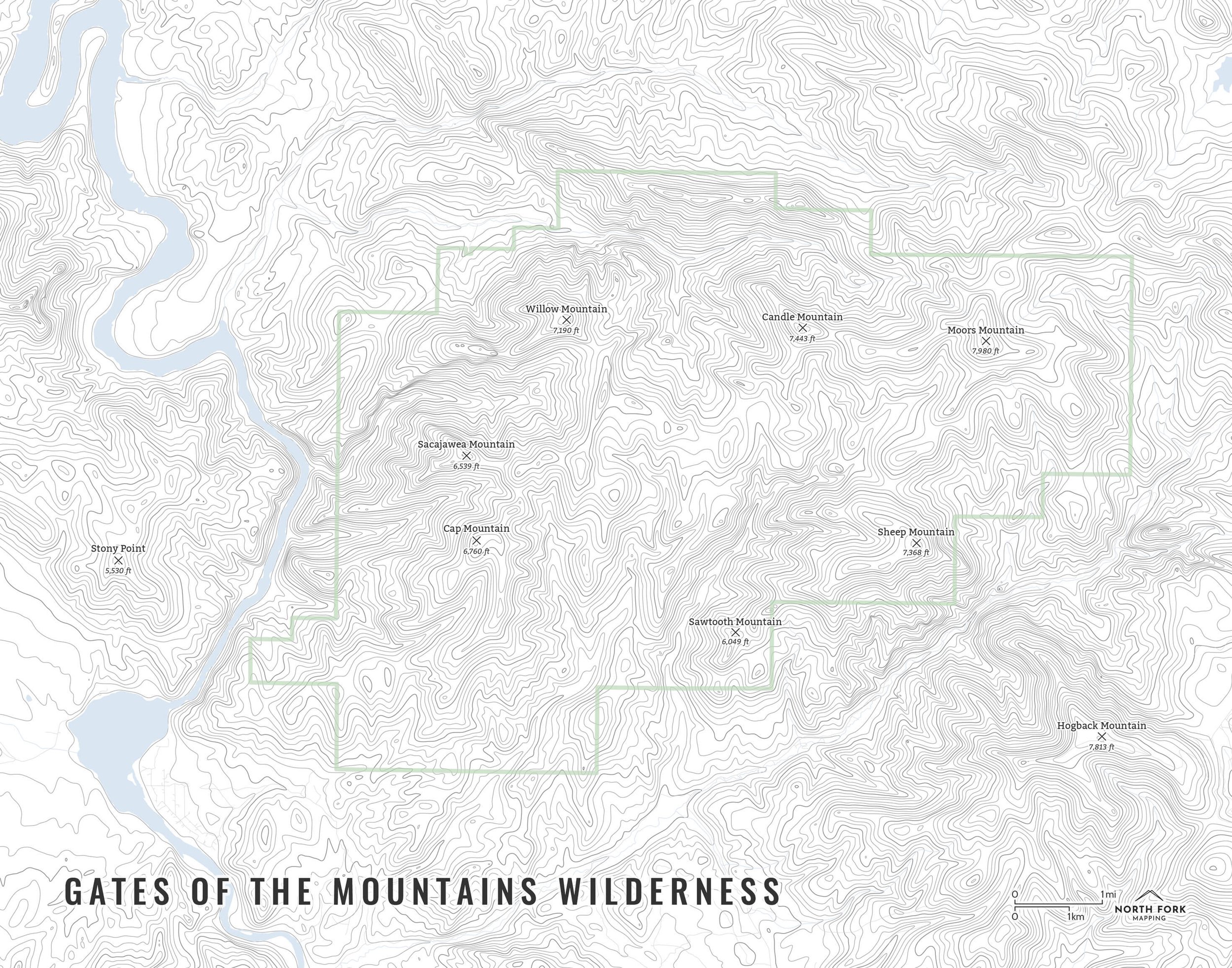
“Just The Basics” - Adding onto the minimalist style with a road network for reference, mountain summit points, lake bays, and a scale bar. A basic map.

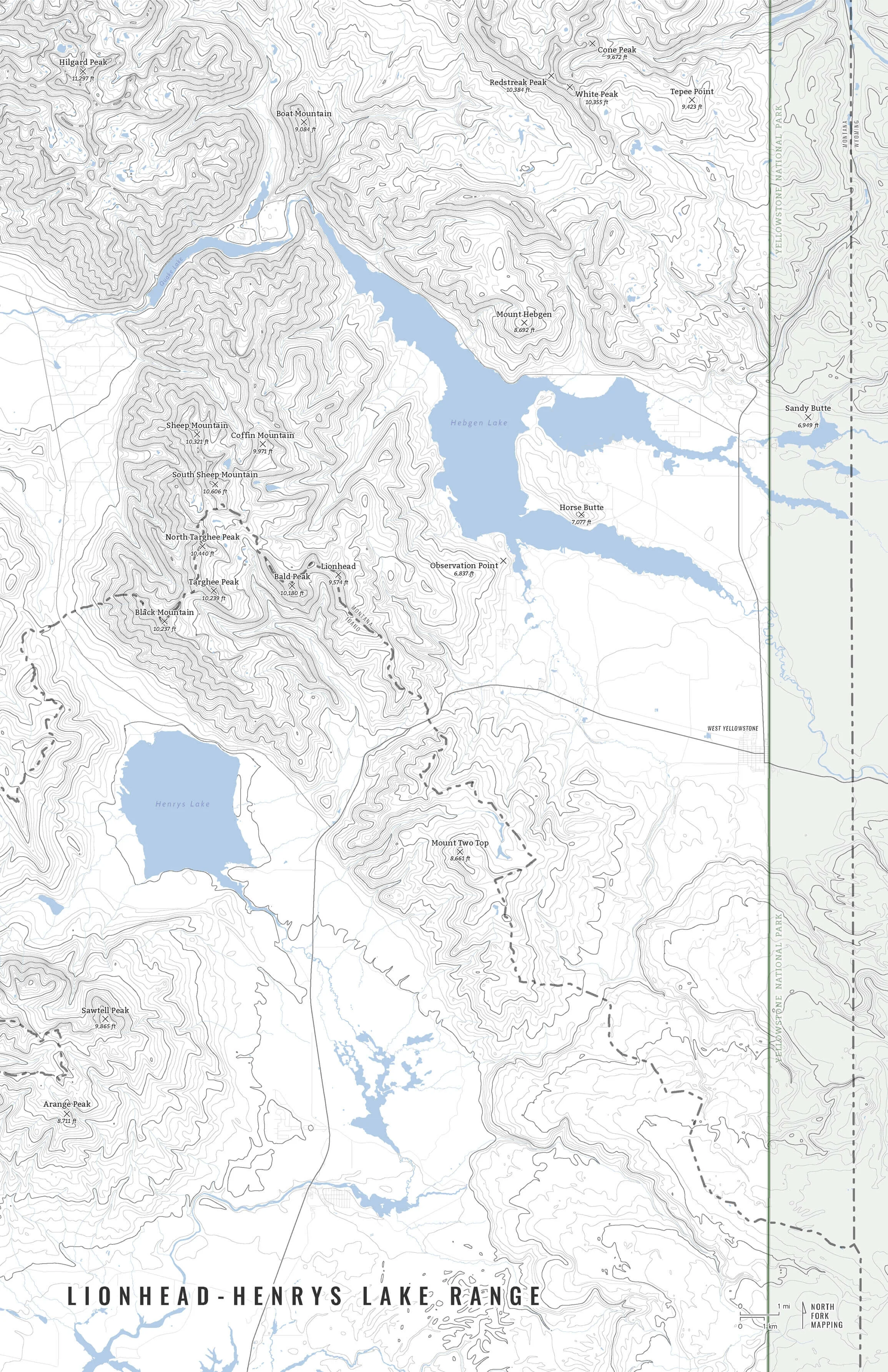
“All The Things” - Just as it sounds. The mappiest of them all. Adds in trails, stream labels, town labels, and common place name labels.

You Might Also Like

Flint Creek Range FlintCreekRange_all_11x14-01.jpg FlintCreekRange_basics_11x14-01.jpg FlintCreekRange_min_11x14-01.jpg
Flint Creek Range
from $34.00
Gates of the Mountains Wilderness GatesOfTheMountainsWilderness_screenshot.JPG GatesOfTheMountainsWilderness_all_11x14-01.jpg GatesOfTheMountainsWilderness_bas_11x14-01.jpg GatesOfTheMountainsWilderness_min_11x14-01.jpg
Gates of the Mountains Wilderness
from $34.00
Lionhead - Henrys Lake Range HenrysLakeRangeMap_AllTheThings-01.jpg HenrysLakeRangeMap_JustTheBasics-01.jpg HenrysLakeRangeMap_Minimalist-01.jpg HenrysLakeRangeMap_screenshot.JPG
Lionhead - Henrys Lake Range
from $34.00
The Sawtooths TheSawtoothsMapZoom.JPG Sawtooths_all_16x20_1.jpg Sawtooths_basics_16x20_1.jpg Sawtooths_min_16x20_1.jpg
The Sawtooths
from $34.00
Montana Tallest Peaks Tallest-Peaks-Of-Montana-Green-North-Fork-Mapping-Framed.jpg Tallest-Peaks-Of-Montana-Gray-North-Fork-Mapping-Framed.jpg Tallest-Peaks-Of-Montana-Blue-North-Fork-Mapping-Framed.jpg Tallest-Peaks-Of-Montana-Red-North-Fork-Mapping-Framed.jpg
Montana Tallest Peaks
from $46.00

NORTH FORK MAPPING

COPYRIGHT © 2020-2025, NORTH FORK MAPPING, LLC

Frequently Asked Questions

Contact Us

NFM_Main logo b+w_smaller.jpg