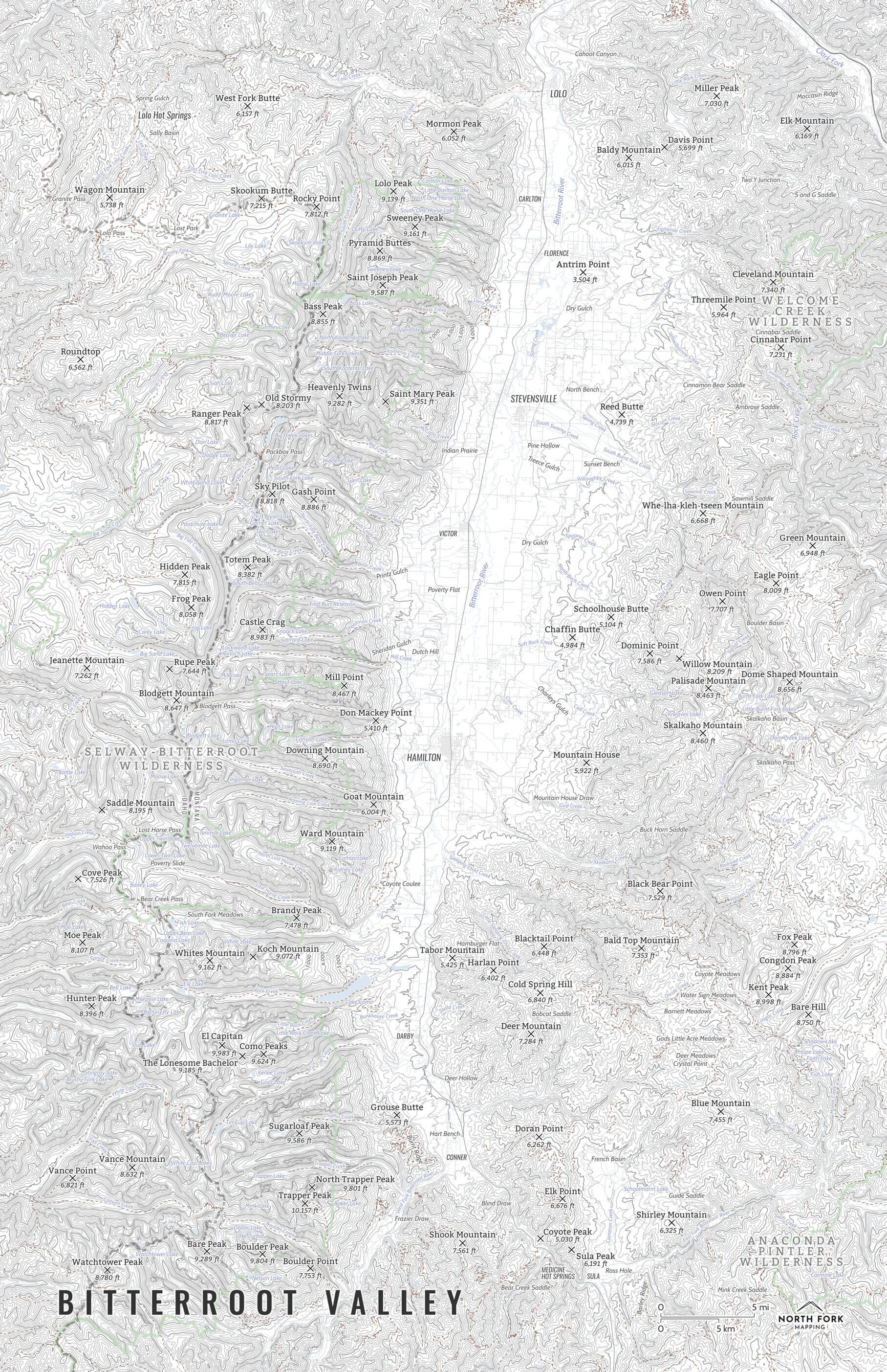


Bitterroot Valley
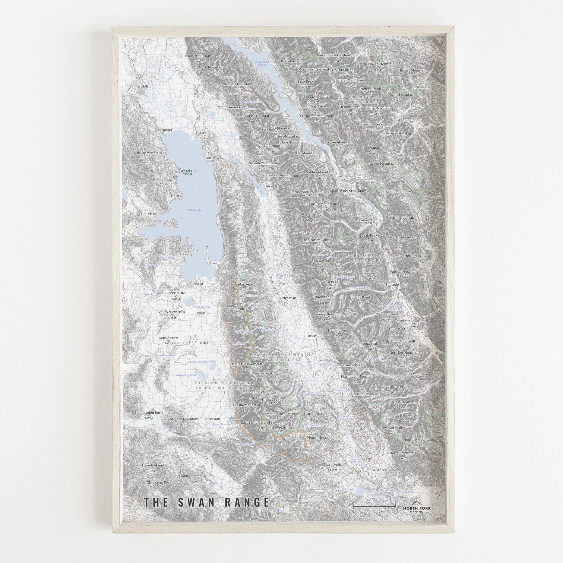
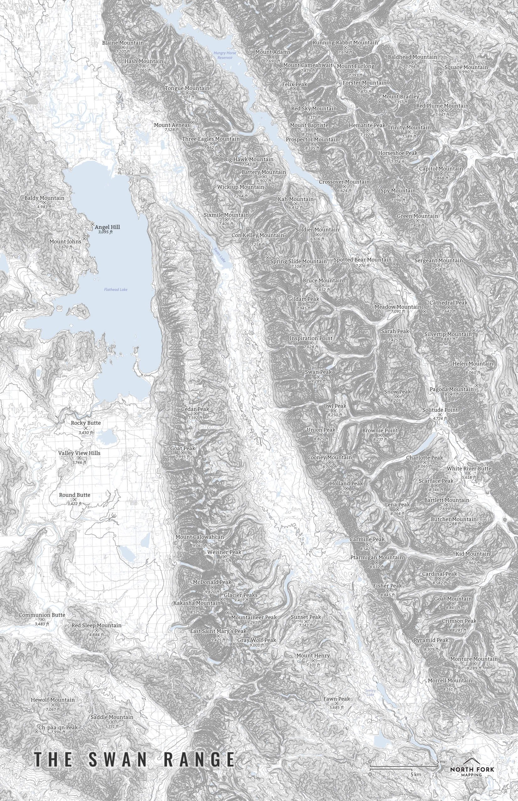
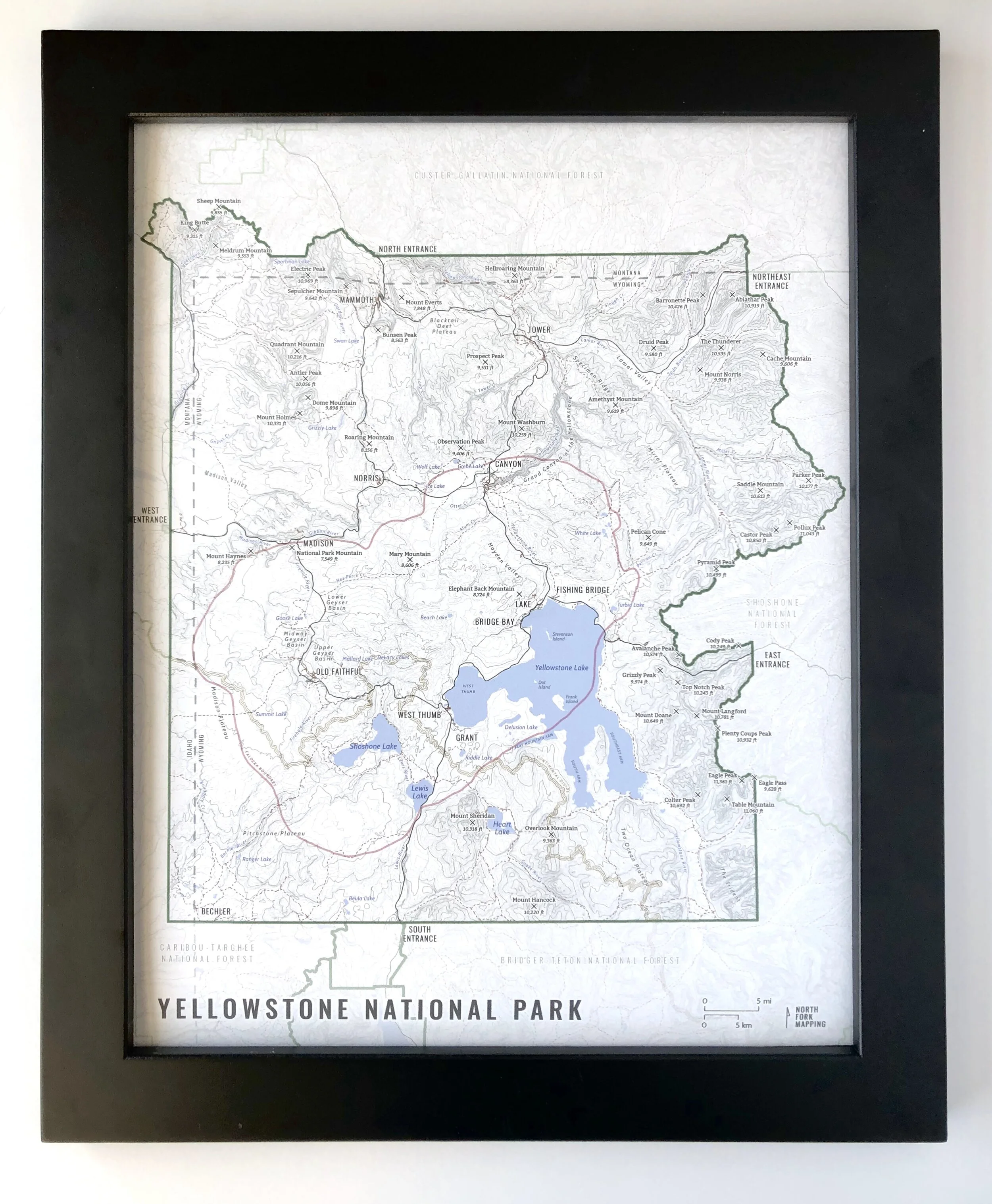
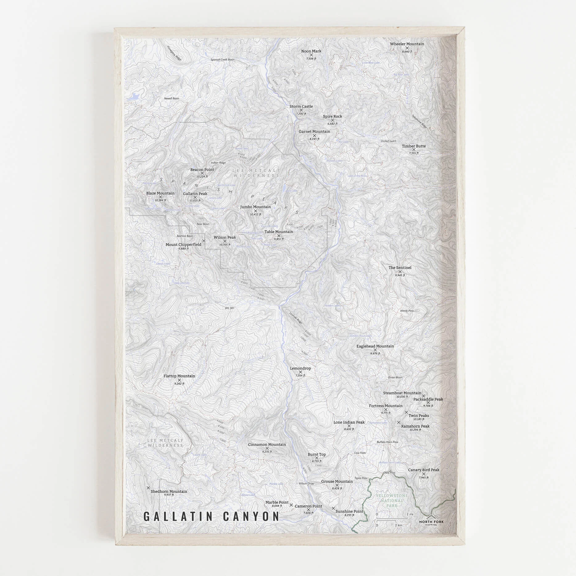
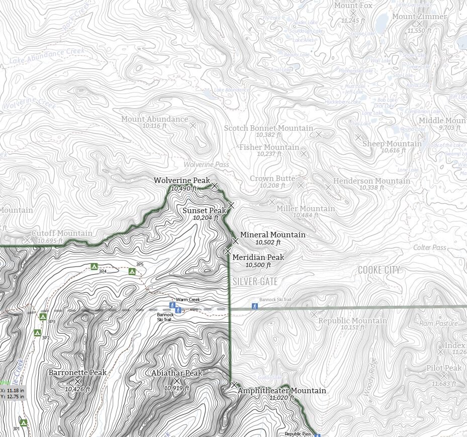
A map of the Bitterroot Valley! This map covers the eastern edge of the Central Bitterroot Range across to the western edge of the Sapphire range and extends from Sula to Lolo.
See below for descriptions on our three signature styles. If you want the most amount of detail, I suggest the 16”x24” or larger as some of the smaller stream names are removed from the 11”x17” due to space.
Prints are shown framed for display purposes only.
A map of the Bitterroot Valley!
We have three signature styles of map depending on what you’re looking for:
“Minimalist” - This map has the title as well as hydrology and contour lines. Clean, simple, elegant. More of an “art” look than a “map” look.
“Just The Basics” - Adding onto the minimalist style with a road network for reference, mountain summit points, state boundary, and a scale bar. A basic map.
“All The Things” - Just as it sounds. The mappiest of them all. Adds in trails, lake labels, stream labels, town labels, wilderness boundaries and labels, and common place name labels.