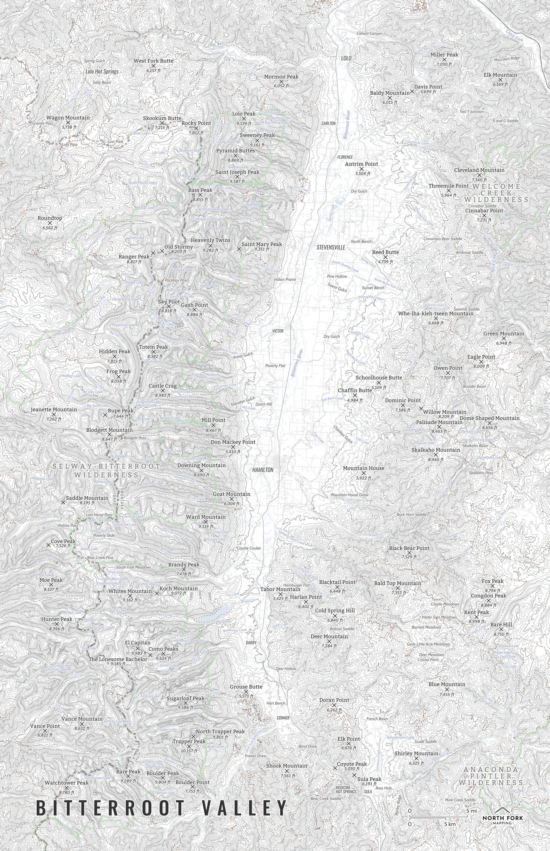
Beartooth Plateau Map
A map of the Beartooth Plateau! From Beartooth Pass to Granite Peak, if you love the Beartooths we’ve got the map for you. This map covers the eastern portion of the Absaroka-Beartooth Wilderness stretching from Silver Gate/Cooke City to Red Lodge and covers the entire Beartooth Highway. Mountain summits, lakes, and glaciers are all a prominent feature on this map. Due to the level of detail, this map is available in 16”x20” and 24”x30”. If you’re a Beartooth junkie, we highly suggest the 24”x30”!
See below for descriptions on our three signature styles.
Prints are shown framed for display purposes only.
Map of the Beartooth Plateau!
We have three signature styles of map depending on what you’re looking for:
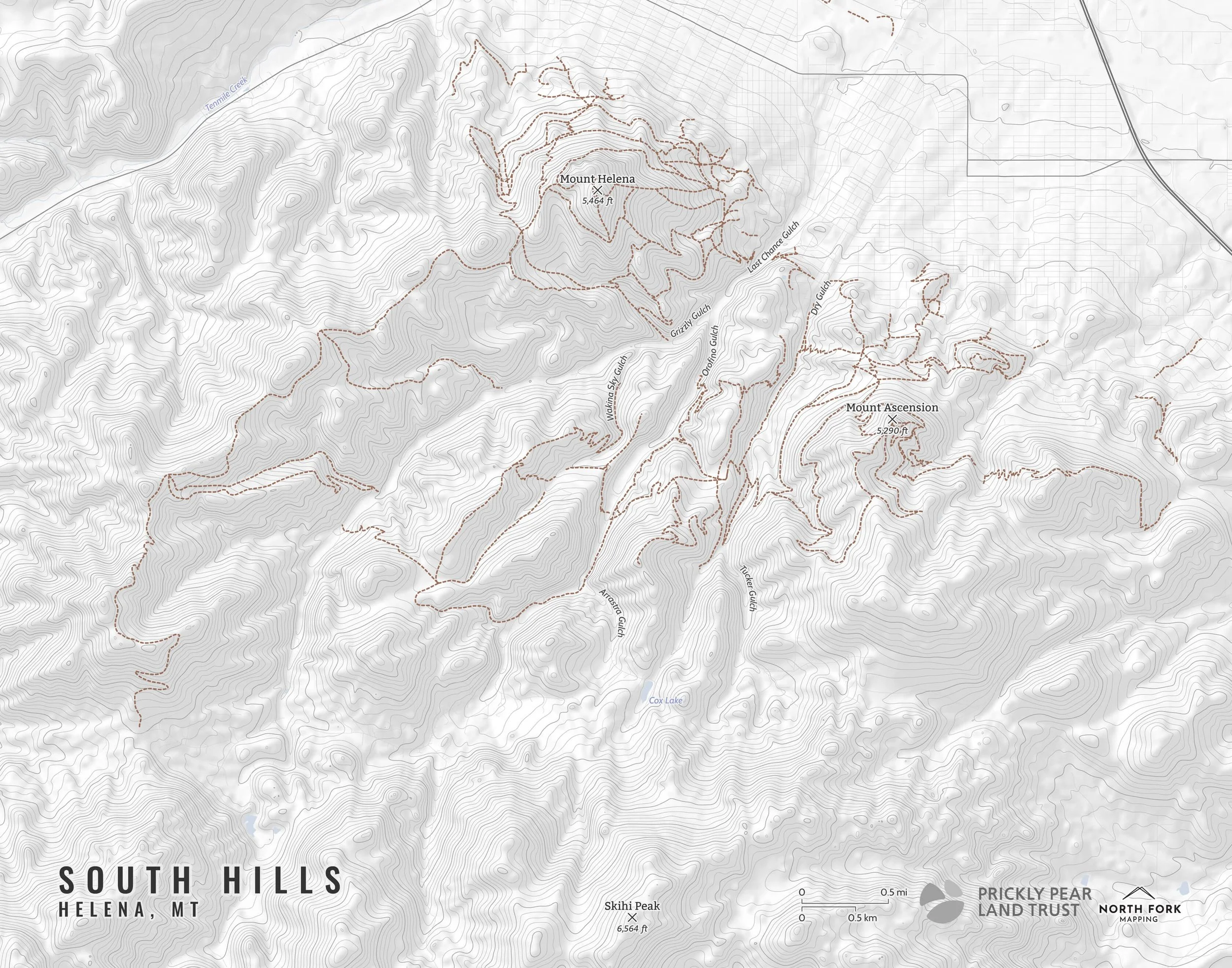
“Minimalist” - This map has the title and topo lines as well as hydrology, glaciers, and a faint road network for reference. Clean, simple, elegant. More of an “art” look than a “map” look.
“Just The Basics” - Adding onto the minimalist style with mountain summits. A basic map.
“All The Things” - Just as it sounds. The mappiest of them all. Adds in town names, trails, common place names, state boundary and labels, glacier labels, labels and boundaries for the wilderness areas and Yellowstone, stream and lake labels.